
Virtual Field Trips
Welcome to the Virtual Geoheritage Field Trip to Canada's National Capital Region
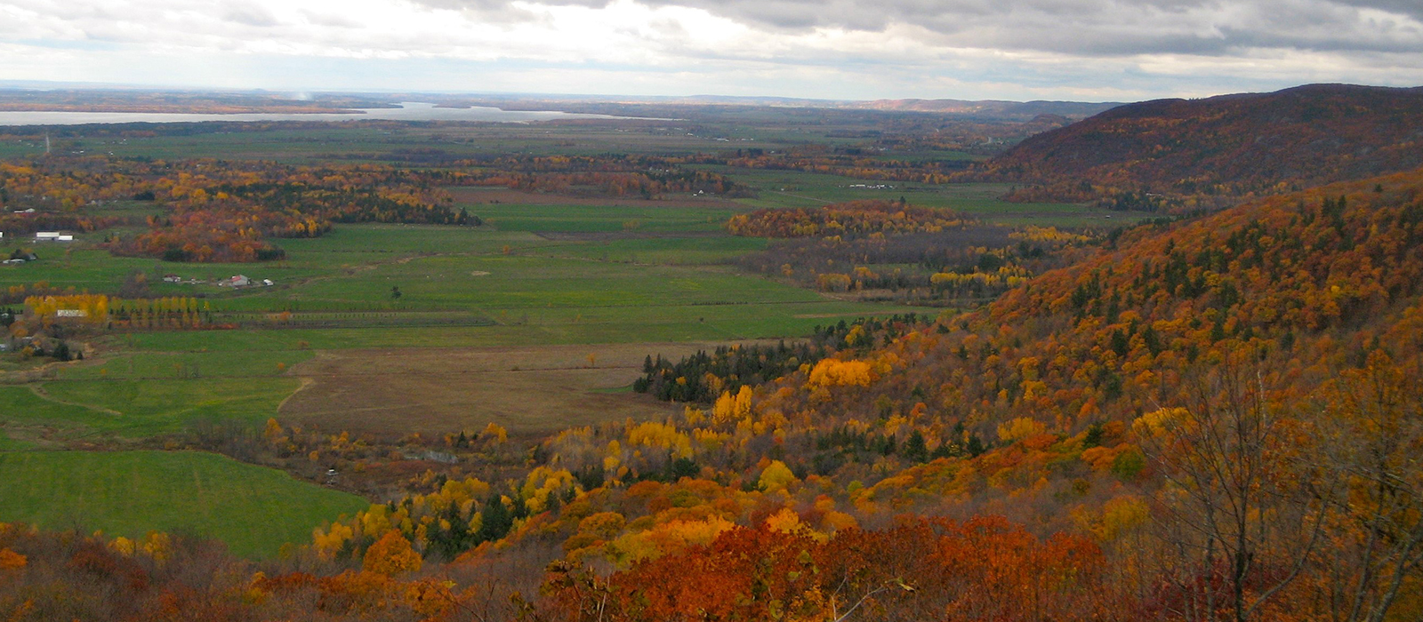
Tour the National Capital Region
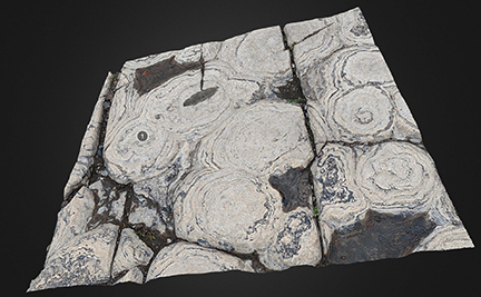 | 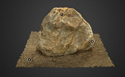 |
Stromatolites on the Ottawa RiverThe most spectacular place to view stromatolites can be found less than 100 meters upstream from the interprovincial Champlain Bridge, in Gatineau, Quebec, Canada. This 3D model is of a small section at the site and was generated processing 348 images. Thanks for this image from Martin John Smith | Bellwood Boulder3D image of the “Bellwood Boulder” a glacial erratic found during sewer construction in Old Ottawa South. Local residents petitioned the City of Ottawa to save and it is now located in Windsor Park, behind the bus shelter at the park entrance on Riverdale Avenue. The boulder is composed of ~520 million year old (Cambrian) Nepean Sandstone and was moved approximately 10000 years ago during the most recent glaciation, from it’s original location somewhere northwest of Ottawa to the Old Ottawa South neighbourhood. Thanks for this image from Martin John Smith |
Other Virtual Geology Field Trips:
- The Association of Professional Geoscientists of Ontario Education Foundation builds virtual geology field trips in Ontario, including Geotrails along the Bruce Trail, the Niagara area and around the Ottawa region. You can find them and more resources on the GeoscienceINFO website : GeoscienceINFO Virtual Field Trips
- The Group of Seven driving tour guide in Ontario can be found here https://momentsofalgoma.ca/en/route/driving-tour/6/
- The University of Toronto-Scarborough, the University of Waterloo, the Ontario Geological Survey and the Oil, Gas and Salt Library have partnered to build an open education resource (OER), the Geology of Southern Ontario. https://storymaps.arcgis.com/collections/80c3ac91abc5451ca23cd16c85f0dfe4?item=1
- The Métro @ Montérégie Team, a group of geoscientists and educators from McGill and Montréal Polytechnique, have built dynamic virtual field trips that work from your home office or your mobile device. To see virtual geology field trips in the Montreal area, visit https://www.mcgill.ca/eps/outreach/virtual-fieldtrips
- Virtual Tour of the landscapes of Nova Scotia https://novascotia.ca/natr/meb/fieldtrip/START.ASP
Other maps, resources and interactives:
- The Saskatchewan Geological Society has created the digital Geological Highway Map of Saskatchewan. You can find it here at GeoExplore Saskatchewan https://sgshome.ca/outreach/geoexplore-saskatchewan
- Geoheritage Sites of Nova Scotia interactive map of sites that tell the story of the geological and cultural evolution of Nava Scotia, and in some cases, planet Earth itself. https://fletcher.novascotia.ca/DNRViewer/?viewer=Geoheritage
- The Field Guide to the Identification of Pebbles, created by Eileen Van der Flier-Keller is a full colour, waterproof, accordion folded pocket guide found in local bookstores or order from the publisher Harbour Publishing at Harbour Publishing Field Guide to Pebbles
- Free printable Nova Scotia Pebbles, a guide to identification from the Atlantic Geoscience Society: https://atlanticgeosciencesociety.ca/wp-content/uploads/2020/11/NSPebbles.pdf
- Four Billion Years and Counting is a Canadian content, easy to read geology textbook for everyone created through the efforts of the Canadian Federation of Earth Sciences. You can find out more about this book and the associated teacher resources here Four Billion Years and Counting