There are lots of ways to participate in Geoheritage Day! Visit exceptional geological sites in the National Capital Region and all across Canada, virtually, in person on your own, or you can join us for our annual live event, held each fall in Ottawa/Gatineau. Or build your own Geoheritage Day event in your region!
For more information about this year's in-person event in Ottawa, visit the Carleton University Department of Earth Sciences page.
We have added more sites across Canada so be sure to expand the map and check them out.
Learn more about how geological processes have shaped the local, regional and national landscape, given us a glimpse into past environments and life forms and provided resources for our use. We have enhanced our digital presence so that you will also be able to visit virtually or on your own during the rest of the year, and learn how each site fits into the local geological history.
Please follow local guidelines and regulations, and remember that collecting on NCC properties, National and Provincial Parks and Geoparks is prohibited.
We would love to receive photographs of you visiting the geoheritage sites. We'll post these pictures on our webpage and social media outlets. Please email pictures to: earth.sciences@carleton.ca
Did you know?
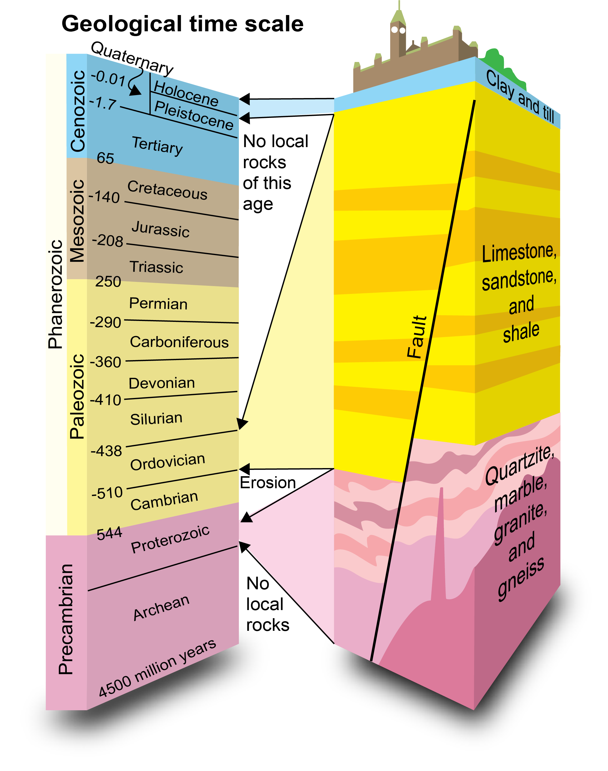
In the last 2 billion years our National Capital has been home to a huge mountain chain, a tropical beach, a habitat for large whales, and buried under 2km of ice…
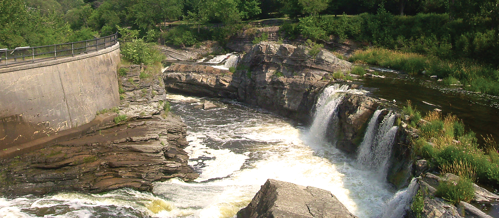
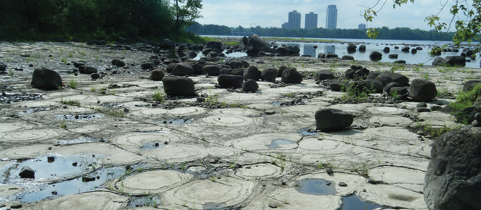
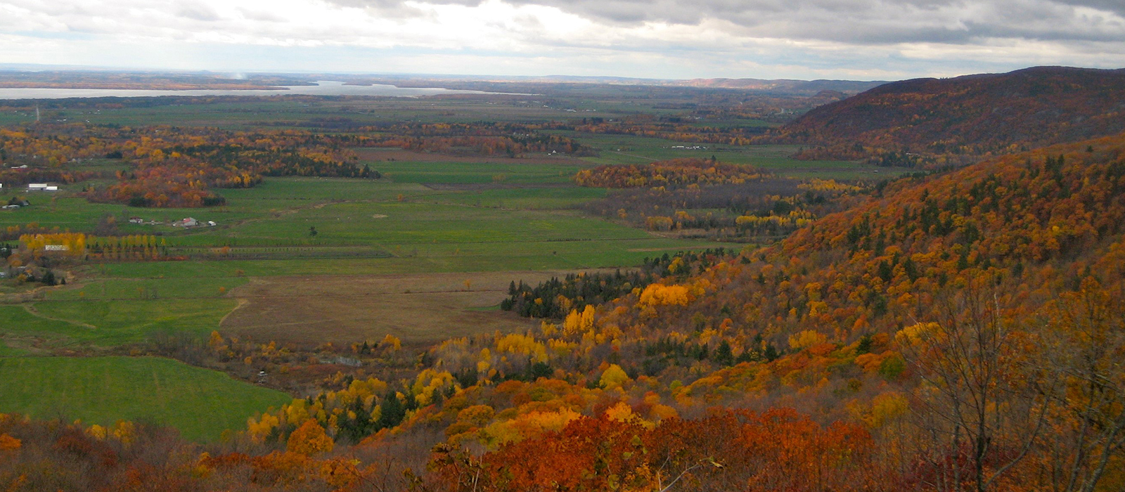
Many unique geological and surface landform features provide important records of the past in the Ottawa-Gatineau region. These include the billion-year-old Precambrian rocks of the Gatineau Hills, the 450 million-year-old fossil-bearing Paleozoic rocks of the Ottawa Valley and the unconsolidated sediments produced during the last Ice Age and during the subsequent time when the Champlain Sea covered much of the Ottawa Valley, less than 10,000 years ago. The present drainage systems, dominated by the Ottawa River, have been incised into this geological assemblage, and many areas within the region have been subjected to significant modification by landslides. These components of our local natural history strongly influence the groundwater reservoirs, surface waterways, agriculture sustenance, mineral wealth, biodiversity and the foundations for buildings and transportation.
A TRIP THROUGH TIME - THE LAST TWO BILLION YEARS IN OTTAWA Jan Aylsworth and Jean Dougherty
Explore Geoheritage Day was initiated in 2006 by Beth McLarty Halfkenny, Carleton Earth Sciences Curator and Outreach Coordinator to celebrate the diversity of exceptional sites of geological significance within the National Capital Region of Canada. Held each year on a sunny autumn Saturday, the event invites the public to come out to their local parks and green spaces and learn how geological processes have shaped our landscape, given us a glimpse into past environments and provided resources for our use. Sites are hosted by volunteers from Carleton’s Department of Earth Sciences, the Ottawa-Gatineau Geoheritage Project, our partners from the Cardinal Creek Community Association and Biodiversity Conservancy International, as well as retired geoscientists and Geoheritage enthusiasts. During the pandemic, the event continued in digital version, with sites from across Canada added to the geosite map and the creation of the Canada-wide Geoheritage Day website! Although we are back to hosted sites for the Ottawa annual event, the website give us an added National reach and accessibility. We will continue to add publicly accessible sites to the map, so that folks across Canada can go out or stay in and discover Geoheritage in their own neighbourhoods.
A Geoheritage Site is a locality that meets one or more of the following:
Exposes a significant record of natural history
Contains characteristic or unique features
Contributes to understanding the natural history of the region